The Making of NASA's Global Selfie: 100+ Countries, Thousands of Photos
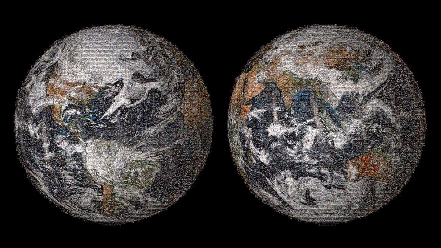
The result is a zoomable 3.2-gigapixel image that people can scan and explore to take a closer look at the variety of pictures. The mosaic is hosted on the Web by GigaPan.
The mosaic is based on views of each hemisphere that were captured on April 22, 2014, by the Visible Infrared Imaging Radiometer Suite instrument on the Suomi National Polar-orbiting Partnership (NPP) satellite, a joint NOAA-NASA mission. The diagonal stripes in the images are due to the satellite capturing the reflection of sunlight off ocean waters.
The year 2014 is a significant one for NASA Earth science. For the first time in more than a decade, five missions designed to gather critical data about our home planet are launching to space in a single year. The first, the Global Precipitation Measurement mission's Core Observatory, launched in February. Next up is the Orbiting Carbon Observatory-2 (OCO-2), launching from California’s Vandenberg Air Force Base on July 1.
NASA scientists have helped identify thousands of new planets in recent years, but the space agency studies no planet more closely than our own. With 17 Earth-observing satellites in orbit, bolstered by ambitious airborne and ground-based observation campaigns, NASA data helps scientists piece together a clearer picture of Earth’s atmosphere, land and ocean.
Source: